Cities, all over the world, are affected by various unforeseen disasters, natural or man-made. With increasing development of information and communication technologies (ICT), countries are trying to adopt technology for better prediction, and planning for disasters. As per the report “Human Cost of Disasters (2000-2019)”, India is the third most disaster-prone country after China and United States of America. Recent events of floods in various parts of the country have brought up the need to integrate technology in such situations so as to avoid human causalities
With time, technology is taking the lead in almost every sector in order to improve efficiency and capacity. There have been various interventions in information technology including GIS, Remote Sensing, satellite-based data and others, to better implement the disaster risk reduction measures. Along with the United Nations Development Programme, the Government of India has worked to incorporate technology for disaster risk reduction in India. The programme was implemented in two phases from 2012-2016 and 2016-2020 in a total of 10 cities across India namely Bhubaneswar, Gangtok, Madurai, Navi Mumbai, Shimla, Trivandrum, Vijayawada, Visakhapatnam, Cuttack and Shillong, which are geographically in the region of high disaster risk. It aimed to enhance the institutional capacities for reducing disaster risk in urban areas. More such programmes and schemes are needed to build the capacities of local governments and increase the technological interventions to reduce disaster risk.
Ways technology can help during disasters
Local governments are the first line of defense in difficult scenarios as they are in direct contact with community and are aware of the local challenges and ways to tackle them. Local governments along with community groups can do a tremendous job by integrating new modern methods when it comes to preparedness and mitigation. For instance, during the COVID-19 pandemic people came to know about the power of social media and online databases when the health infrastructure collapsed due to extreme shortage of oxygen cylinders and other medical supplies. The same can be replicated for preparations in times of disasters. A comprehensive database of disaster management related inventory and information dissemination system can be critical in reducing delays which is important in case of
sudden events.
Geographic Information System (GIS) based disaster prediction devices can help the administration to plan better for any unforeseen event. GIS are systems that process, store, analyse, integrate and present data in a form that can be useful to predict natural disasters such as floods, and earthquakes. Karnataka State Natural Disaster Monitoring Centre (KSNDMC) provides a good example of this. It provides real-time weather-related information, forecasts, early warnings, and advisories for the management of natural disasters in the area. The system integrates information technology through use of sensors to monitor natural hazards, and provide input for better preparedness and management. The KSNDMC had installed over 6,000 Telemetric Rain Gauges and more than 750 Telemetric Weather Stations to transmit data every 15 minutes. Prior to using technology solutions, KSNDMC collected weather data manually and stored it in an MS-Access database. Countries, around the world, are utilising methods such as Internet of Things (IoT) to minimise the effects of disasters by collecting real-time data on various things such as volcanic activity, and water level. One such innovation was the IoT-based early warning system developed by the Government of Colombia’s National Unit for Disaster Risk Management, which was also mentioned in the document of best practices by International Telecommunication Union named “Disruptive technologies in disaster management”. The system was developed following the floods of Liboriana River, which also triggered a landslide, killing more than 80 people. This IoT-based system consists of five solar powered sensors installed at the Liboriana River to monitor the water levels and air temperature using ultrasound. It automatically sends text messages to local governments if a risk is detected.
ISRO boosting tech in disaster preparedness
Indian Space Research Organisation (ISRO) is actively working towards integrating space technology for example the INSAT series of satellites, which revolutionised the communication system and made it possible to establish connectivity with far flung and inaccessible areas, even off-shore islands. Along with the Ministry of Home Affairs, Government of India, ISRO also set up a satellite based Virtual Private Network helping in accessing secure data through dedicated electronic network. It establishes connection among all the key players during disaster management, i.e. information providers and users at all levels.
Last year, ISRO, through its subsidiary Indian Institute of Remote Sensing, signed a Memorandum of Understanding with the Uttarakhand State Disaster Management Authority to conduct satellite-based mountain hazard assessment. This will help the state get timely alerts for several natural calamities to respond better to such events. ISRO is also an active partner in international events to share knowledge and best practices towards global disaster management. For instance, it is the signatory of International Charter “Space and Major Disasters”, which supports the Authorised Users of charter during major disasters.
Looking forward
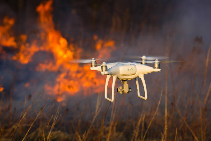
Incorporating information and communication technology in disaster response and preparedness is indispensable for effective implementation of disaster risk reduction measures. There is a need to harness the potential of advanced technologies such as drones, unmanned underwater vehicles, IoT, artificial intelligence, robots, blockchain, and big data. There is a need to empower local governments and local level authorities such as District Disaster Management Authority, and work for their capacity building in order to effectively use latest technologies in disaster
risk reduction.
Japan: Robots to Rescue
The Nagaoka University of Technology (NUT) in Japan partnered with the Nagaoka Iron Industrial Youth Research Association and developed rescue robots through a team led by Dr Tetsuya Kimura, Associate Professor, NUT. The team developed robots which can help in searches and rescue operations following a disaster. The University came up with this innovative approach after the country was hit by a 6.8 magnitude earthquake in Chuetsu district, Niigata Prefecture, in which 68 people died and 4795 were injured in more than 16,000 collapsed houses. Such technological interventions are critical for a country like Japan, where natural disaster is not an uncommon occurrence.
Recently, researchers in Japan have also developed snake-shaped robots that can climb ladders and crawl into drain pipes making it easier for the authorities to reach inaccessible locations during disasters for rescue operation. The robot is 2.5 metres in length and weighs 6 kg, and can be used for inspection of collapsed buildings. A laser sensor is attached to the tip of robot which detects the distance between each rung. It is controlled by an operator who can see via camera mounted on the tip.