 Chennai:The Chennai municipal corporation on November 21 became the first municipal body in India to commission drone mapping of properties and utilities. The project was inaugurated by Tamil Nadu municipal administration minister SP Velumani.
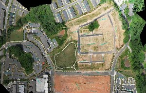
Velumani said that the mapping will facilitate planning of development work for the city on a priority basis. He added that the corporation had to obtain the consent of directorate general of civil aviation, the ministry of home and defence, Intelligence bureau, the district administrations of Chennai, Kancheepuram and Thiruvallur. The mapping project will be executed by the Hyderabad based company RSI Softech India Pvt Ltd. The estimated cost of the project is Rs 6.43 crores. Two hexacopters, costing Rs 21 lakh (each) will be used for the project while two quadcopters will be kept on standby. The project will cover 426 sq km area in 120 days.
The project will be supervised by the Tamil Nadu Water supply and drainage board (TWAD).
The drones will be fitted with high resolution cameras to capture five images per second. These images will have to be processed by the defence ministry before being available to the corporation. Until the data gets verified by the ministry of defence, it will be kept at a secure site in Ripon buildings under the supervision of an official in the rank of an executive engineer.